

A brewing tropical storm is now threatening the coastal areas of several mid-Atlantic states Friday and this weekend with strong winds, potentially life-threatening storm surge and torrential rains that may lead to flash flooding.
This system, now dubbed Potential Tropical Storm Sixteen – formerly Invest 99L — is forecast to become a tropical storm as it approaches the coast of North Carolina, earning the name Ophelia once it’s found to have winds of at least 39 mph. In the interim, earning the name PTC Sixteen allows the NHC to issue Tropical Storm Warnings in anticipation of future development into a tropical storm with a projected near-term landfall.
WHAT IS A POTENTIAL TROPICAL CYCLONE?
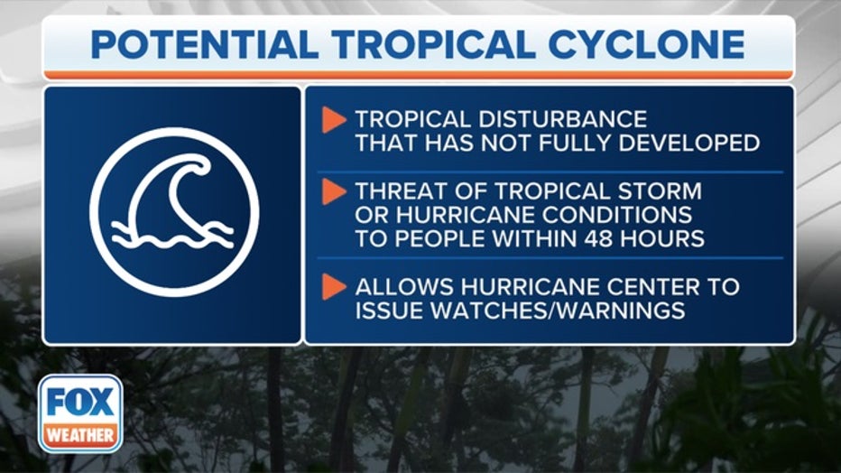
What is a potential tropical cyclone? This graphic breaks down what you need to know. (FOX Weather)
Where are watches and warnings are in effect because of Potential Tropical Cyclone 16?
The NHC has issued a Tropical Storm Warning from Cape Fear, North Carolina, to Fenwick Island, Delaware, including Albemarle and Pamlico sounds in North Carolina and the Chesapeake Bay south of Smith Point, Virginia.
A Tropical Storm Warning is issued when tropical-storm-force winds (39-plus mph) are expected in the warning area within 36 hours. These winds may be accompanied by storm surge, coastal flooding and/or river flooding.
A Storm Surge Watch has been issued from Surf City, North Carolina, to Chincoteague, Virginia, and for the Chesapeake Bay south of Smith Point, Virginia, including Albemarle and Pamlico Sounds in North Carolina.
WHAT TO DO WHEN HURRICANE OR TROPICAL STORM WATCHES AND WARNINGS ARE ISSUED FOR YOUR TOWN
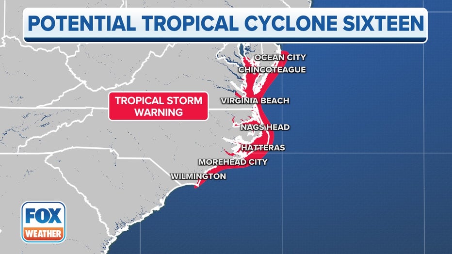
Current watches and warnings in effect along the path of Potential Tropical Cyclone Sixteen. (FOX Weather)
The combination of a dangerous storm surge and the tide will cause normally dry areas near the coast to be flooded by rising waters that move inland from the coast.
The water could reach the following heights:
- Surf City to Chincoteague: 2-4 feet
- Chesapeake Bay south of Smith Point: 2-4 feet
- Albemarle and Pamlico Sounds: 2-4 feet
- South Santee River, South Carolina to Surf City: 1-3 feet
- Chincoteague to Fenwick Island: 1-3 feet
Where is Potential Tropical Cyclone 16?
Potential Tropical Cyclone Sixteen is located about 370 miles southeast of Charleston, South Carolina, and is moving to the north at 10 mph. It has maximum sustained winds of 35 mph with higher gusts.
Where is Potential Tropical Cyclone 16 headed?
Potential Tropical Cyclone Sixteen will continue to head to the north through early Friday. The NHC said a north-northwestward to northward motion is expected by late Friday and will continue into the weekend.
On that track, the NHC says the center of the system will approach the coast of North Carolina within the Tropical Storm Warning area on Friday night and early Saturday. The storm is expected to continue north near or through Virginia and Maryland with much of the Interstate 95 corridor within the cone through the weekend into Monday morning, including Washington, New York City and into southern New England.
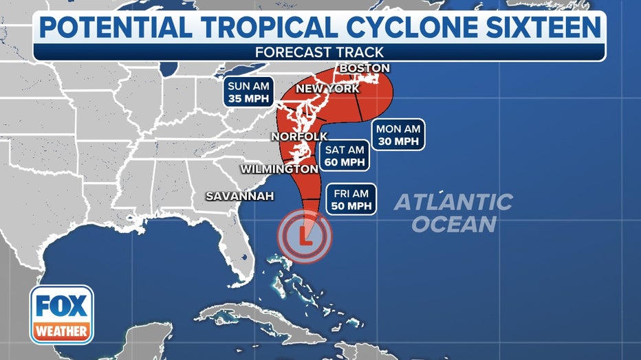
The forecast cone for Potential Tropical Cyclone Sixteen. (FOX Weather)
What are the expected impacts from Potential Tropical Cyclone 16?
Potential Tropical Cyclone Sixteen is expected to cause a storm surge along the coast, as well as produce heavy rain and strong winds.
“People need to not get hung up on the whole ‘does this get a name?’ thing,” FOX Weather meteorologist Britta Merwin said. “Because the impact really does not change.”
The FOX Forecast Center expects impacts from the storm system to begin on Friday as it spins closer to the Southeast and mid-Atlantic coasts.
Several inches of rain are expected to fall from Florida to the Northeast and New England during the event, and strong winds pushing in from the ocean could lead to flash flooding and coastal flooding.
Forecasters say Potential Tropical Cyclone Sixteen could produce 2-4 inches of rain, with locally higher amounts up to 6 inches, across eastern portions of the mid-Atlantic states from North Carolina to New Jersey.
Parts of the Northeast and southern New England could also see higher rainfall totals between 2-3 inches with locally higher amounts.
Power outages are also a concern due to the whipping winds that could bring down trees onto power lines.
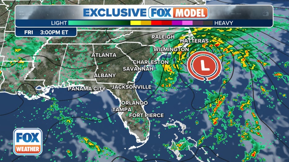
The exclusive FOX Model showing possible conditions on Friday, September 22, 2023.(FOX Weather)
Tropical storm conditions are expected to first reach the coast within the Tropical Storm Warning area in North Carolina starting Friday and will spread to the north over the weekend.
LINK: Get updates and more on this story at foxweather.com.